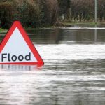
 Floods bring untold damage to communities, so the ability to prepare as best as possible in good time could be invaluable. Research from the University of Dundee proposes an early warning system that uses a combination of Twitter, AI and citizen science.
The system extracts data, both from Twitter and also from mobile phone apps to develop a high-resolution monitoring of urban flooding. The team believe their system is the first to apply computer vision to flooding.
Monitoring urban flooding
Urban flooding is traditionally difficult to model because the data is inherently complex, both to collect and process. This in turn makes risk analysis challenging.
The team found that collecting data from social media and smartphones can effectively complement traditional datasets. When they applied their method to case studies, the tests produced genuine insights.
“Sea levels have been rising at an average rate of 3.4mm a year over the past decade. The extremes of today will become the average of the future so coastal cities and countries must take action to protect their land,” the researchers say.
The team were especially keen to understand flooding that occurs on relatively calm weather days. These kind of floods typically result from the mean sea level being significantly higher. Existing methods of monitoring, including remote satellite sensors, witness statements and insurance reports, all have various flaws, and so the team wanted to tap into the real-time commentary of floods provided on Twitter.
“A tweet can be very informative in terms of flooding data. Key words were our first filter, then we used natural language processing to find out more about severity, location and other information. Computer vision techniques were applied to the data collected from MyCoast, a crowdsourcing app, to automatically identify scenes of flooding from the images that users post,” they say.
Big data
The team collected data from Twitter over a one-month period. They were looking specifically for tweets mentioning ‘flood’, ‘inundation’, ‘dam’, ‘dike’, and ‘levee’, with 7,500 or so tweets of this nature captured.
They paired this up with data from MyCoast, which is a citizen science project designed to capture data about coastal hazards and incidents. It contains approximately 6,000 flood photos that have been submitted via their mobile app.
This data was autonomously extracted via an AI system developed by the team, and then validated alongside precipitation data and road closure reports to determine its quality. The analysis revealed that flood-related tweets were a strong correlation with precipitation levels, whilst the mobile data was a good match with road closure reports.
The team believe, therefore, that the system could provide a useful and cost effective way of providing large-scale monitoring, whilst also provide rich and customized information at a micro level.
The system is currently capable of around 70% accuracy, but the team are working with the images available on MyCoast to further train and refine the system so that it’s capable of near perfect accuracy levels. They’re confident that it can have real utility however.
“Taken together, these tools can be used to monitor the water penetration of urban flooding over a city. This can be then used to improve forecasting models and early warning systems to help residents and authorities prepare for an upcoming flood,” they say. “By combining social media, citizen science and artificial intelligence in urban flooding research, we hope to generate accurate predictions and provide warnings days in advance.”