 The lifeblood of the autonomous vehicle are the detailed maps they used to navigate their surroundings. The ability to create such detailed maps has been a challenge for the industry, and has indeed seen various attempts to mitigate the need for scanners to travel ever inch of the world’s roads.
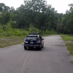
For instance, researchers from MIT developed a system, called RoadTracer, that creates detailed maps purely from aerial photos of a road network. Another MIT team have developed an alternative solution, called MapLite, which they claim enables navigation with just GPS and sensors.
They believe that the system allows autonomous vehicles to navigate without relying upon maps, and therefore to travel in places never before visited by mapping vehicles. It achieves this by combining the GPS data you find in standard Google Maps with an array of sensors that can observe the road conditions in real-time. This allows them to understand road conditions over 100 feet in advance.
“The reason this kind of ‘map-less’ approach hasn’t really been done before is because it is generally much harder to reach the same accuracy and reliability as with detailed maps,” the researchers say. “A system like this that can navigate just with on-board sensors shows the potential of self-driving cars being able to actually handle roads beyond the small number that tech companies have mapped.”
Sensing on the fly
MapLite aims to help vehicles navigate in a more similar way to humans. The GPS data gives a rough estimate of the car’s location, with the system aware of its intended destination. Alongside this final destination is a local navigation goal, which has to be within view of the car. The sensors attached to the vehicle then generate a path to this point, with LIDAR used to gauge the location of the road’s edges.
“Our minimalist approach to mapping enables autonomous driving on country roads using local appearance and semantic features such as the presence of a parking spot or a side road,” the team say.
Of course, there are other ‘map-less’ approaches to autonomous vehicles, but most of these rely on machine learning to understand the vehicle’s environment having been trained on similar roads. Instead, MapLite uses modeling techniques to produce the same results.
The team admit that the system still has work to be done on it. For instance, it still has reliability issues on mountain roads as it has difficulties accounting for significant changes in elevation. The team are actively working on these challenges however, and they hope to have a system that can reach comparable levels of performance and reliability as mapped systems, but with a much broader range.
“I imagine that the self-driving cars of the future will always make some use of 3D maps in urban areas,” they explain. “But when called upon to take a trip off the beaten path, these vehicles will need to be as good as humans at driving on unfamiliar roads they have never seen before. We hope our work is a step in that direction.”
It’s a fascinating project, and you can learn more about it via the video below.