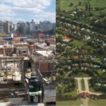
 Inequality may seem something that is all too evident, as run down streets and communities show visible signs of lacking due care and attention, but in many communities poverty can lie out of plain sight. New research from Imperial College London suggests deep learning can be used to better detect social, economic, environmental and health inequalities than existing methods.
The researchers believe their system can help policy makers gain a greater understanding of the inequalities that exist within their city, and therefore have more informed policies for tackling them. What’s more, the real-time nature of the metrics allow more effective interventions to be crafted.
The team’s deep learning based system was trained on publicly available street view images from London, Birmingham, Manchester and Leeds combined with government statistics. In total, the team used over 150,000 images for London, with this then used to test the model on the other cities. A number of key features emerged to give clues as to the equality levels of each city. These include the quality of housing and the living environment.
The system was able to monitor the quality of building materials, any sign of their disrepair together with that of local cars and shops. When they combined this with official government statistics on things such as average income, mortality and housing conditions, they were accurately able to train the mode before being tested on other cities where such statistical data was not visible.
Suffice to say, it’s very early days for the system and it’s nowhere near being deployed in practice, but we’ve already seen data from Street View used to accurately portray various aspects of a community, so this approach seems one with legs.