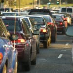
 Earlier this year some research emerged from MIT that used the data we transmit via our mobile phones to aid traffic management, and in particular to reduce congestion during rush hour. They used three weeks of cellphone data to obtain information about anonymous drivers’ routes and the estimated traffic volume and speed on those routes both in Boston and the San Francisco Bay Area.
This information was then combined with knowledge of population densities and information about the road network in those areas. This was used to understand both which areas were the largest sources of drivers and how they moved from local roads to main roads.
A similar project has been recently completed by IBM as part of their smarter cities work. The researchers have collected positional data from millions of mobile phone users in Ivory Coast in an attempt to create a new model for optimising urban transport systems.
While the results were preliminary, they point to the new ways that urban planners can use mobile data to design infrastructure, says Francesco Calabrese, a researcher at IBM’s research lab in Dublin, and a coauthor of a paper on the work. “This represents a new front with a potentially large impact on improving urban transportation systems,” he says. “People with cell phones can serve as sensors and be the building blocks of development efforts.”
The work focused on Abidjan, the largest city in Ivory Coast, and in particular on their bus and taxi journies. They studied the mobility data created when people place a call or send a text from around 500,000 phones to find information relevant to the commutes people take.
The results of the research saw suggested changes to the bus routes in Abidjan that could potentially cut journey times by around 10%. The model generated by the research suggested 65 possible improvements, with a recommendation to add two new routes and extend an existing one in order to provide an improved service to passengers.
Of course, unclogging one transportation route can have unanticipated problems, like attracting more people to use that route, perpetuating the problem. Still, if the data were available in real-time—rather than months after it was created—the results could be even more powerful. “This would provide snapshots of people moving around in a city, allowing the optimal shifting of routes, and reducing travel and wait times,” Calabrese says.