 I wrote a while back about the Natural Capital Project, which was using the photos people had uploaded to Flickr to try and gauge the popularity of various national parks in the US.
Since then, of course, there have been a raft of new social and mobile apps that allow nature lovers to participate in conservation work in some way.
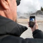
Consider for instance the NPS Geysers app (Android | Apple) that is providing visitors to the Yellowstone national park with accurate information on when the Old Faithful geyser is set to next erupt.
“People in Yellowstone don’t want to know if it’s noon or 1 p.m. Mountain Standard Time; they want to know how long it will be until Old Faithful erupts again,” the developers say. “That shifting of a community to Old Faithful time is fascinating, and represented in many analog forms at the park, such as on white boards, and on hand-spun clocks. We wanted to start building our research project on the idea that Old Faithful time reflects a new way of looking at the world. And then we wanted to open that perspective up to people both inside and outside of the park, through the affordances of mobile technologies.”
The app comes with a live webcam of the geyser basin, including Old Faithful herself. The app also informs users of when each geyser is predicted to erupt next, allowing them to either dash over to the spot, or watch it online.
Crowdsourcing snowfall
Of course, whilst the app is interesting, it is largely a one way flow of information. The catchily titled CoCoRaHS—the Community Collaborative Rain, Hail and Snow Network – project shows what can be done when you involve people in the whole process.
CoCoRaHS was first envisioned way back in 1997 after a particularly harsh bout of rain caused terribly flooding in Colorado, causing more than $200 million worth of damage to the region.
“Nothing in the radar indicated that the storm would cause this much damage,” said Nolan Doesken, state climatologist at the Colorado Climate Center at Colorado State University, and founder of CoCoRaHS. “There was incredible variation in the amount of rainfall within the affected area—from less than 2 inches to more than 14 inches (which was close to the average rainfall for the whole year) over a distance of just 5 miles.”
That tragic event prompted officials to enlist the help of those in the community to provide regular reports on rain and snowfall in their part of the country.
Since its inception, over 46,000 people have signed up to the project, armed with a 4″ diameter rain gauge and a lot of enthusiasm. Each participant is given training on where they should place their gauges to ensure the best readings. Whenever rain falls, they take the measurements from their device and submit it to CoCoRaHS.
The data from this army of citizen scientists is then displayed on the CoCoRaHS website, providing valuable and accurate readings for scientists, farmers, hydrologists, and of course the general public.
The developers believe their network of volunteers provide a more accurate picture than more traditional methods, largely because of the huge number and variety of readings they receive from the community.
It’s also providing an invaluable educational service by giving volunteers the chance to do things that are traditionally the domain of scientists.
In addition to hosting the volunteer network, CoCoRaHS also run a webinar each month whereby experts in the field share their views on some aspect of weather or climate. Previous webinars have included topics such as lightning, cloud formation and so on.
“We hear from many of our volunteers that they had no idea that precipitation varied so much,” said Doesken. “Some volunteers regret not having gone into science in college. Some say that they wish they’d pursued a scientific career—but that this this experience is giving them an outlet.”
thanks adi i always used Android