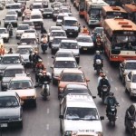
 Traffic congestion is a very modern disease. Average speeds in central London struggle to get above 10 miles per hour as cars stutter along our congested highways. With above inflation rail price rises announced recently it seems likely that more cars will be hitting the roads, although as a cyclist I’m hoping people take to two wheels rather than four.
New research suggests that the humble mobile phone might help planners with traffic management. The researchers have used anonymous mobile phone data to understand exactly how people currently drive.
Lead researcher Marta González, an assistant professor of civil and environmental engineering at Massachusetts Institute of Technology and former MIT postdoc Pu Wang, now a professor at Central South University, used three weeks of cellphone data to obtain information about anonymous drivers’ routes and the estimated traffic volume and speed on those routes both in Boston and the San Francisco Bay Area.
They found the drivers home area by analysing the regularity of the route people drove, plus the location of mobile phone masts that were handling their calls between 9pm and 6am (ie when they were at home).
This information was then combined with knowledge of population densities and information about the road network in those areas. This was used to understand both which areas were the largest sources of drivers and how they moved from local roads to main roads.
Drivers do not congest equally
The research found for instance that cancelling or delaying the trips of 1% of all drivers can reduce delays caused by congestion by 3%. If you cancel the trips of 1% from a particular part of town however it can reduce congestion by 18%.
“This is a preliminary study that demonstrates that not all drivers are contributing uniformly to congestion,” says coauthor Alexandre Bayen, associate professor of electrical engineering and computer science and of civil and environmental engineering at the University of California, Berkeley. “Reaching out to everybody to change their time or mode of commute is thus not necessarily as efficient as reaching out to those in a particular geographic area who contribute most to bottlenecks.”
So in other words, the research reveals that current congestion management strategies are a rather blunt instrument, as our contribution to congestion is far from equal. Quite how officials will implement their recommendations though is another matter, as you can imagine the political powder keg of suggesting some neighbourhoods don’t travel at particular times.
Does this apply to any city?
Because the new methodology requires only three types of data—population density, topological information about a road network, and mobile phone data the researchers believe it can be applicable to any urban area.
“In many cities in the developing world, traffic congestion is a major problem, and travel surveys don’t exist,” González says. “So the detailed methodology we developed for using cellphone data to accurately characterize road network use could help traffic managers control congestion and allow planners to create road networks that fit a population’s needs.”
Whether it will of course is another matter entirely.