 The sheer volume of mobile data has made prediction making and pattern matching increasingly possible. This has manifested itself in a huge number of ways, from better dating to understanding congestion, tracking unemployment to predicting student performance, with resulting analysis often creating beautifully visual displays of human behavior.
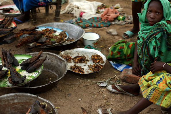
A recent project is attempting to use mobile data to predict the onset of famine. The project, which was documented in a recently published paper, attempts to bring a richer array of data to the task in addition to things such as weather and soil data.
Mobile food security
The Austrian based team have developed a way to monitor food security using a smartphone app. The app uses weather and soil moisture data and combines this with crowdsourced data on the vulnerability of the population.
The first step was to tap into detailed and accurate satellite data to capture things like soil moisture. This is done by scanning the Earth’s surface with microwave beams. By then comparing this data with data sets obtained over the last 20/30 years, the researchers could calculate the moisture levels in the soil.
“This method works well and it provides us with very important information, but information about soil moisture deficits is not enough to estimate the danger of malnutrition,” the authors say. “We also need information about other factors that can affect the local food supply.”
These other factors can include political unrest, which can stop people from farming even under fine weather conditions. This kind of information is impossible to capture from satellites, so the team turned to smartphones to crowdsource its collection.
Crowdsourcing socio-political data
“Today, smartphones are available even in developing countries, and so we decided to develop an app, which we called SATIDA COLLECT, to help us collect the necessary data”, they say.
The researchers put their approach to the test in the Central African Republic. Local staff from MSF were given one days training on data collection, and then went off to conduct hundreds of interviews.
The aim was to understand things like eating rates in the area and whether malnutrition was common in the family. The team hoped to uncover hints as to what the future might have in store.
“Sometimes all that people have left to eat is unripe fruit or the seeds they had stored for next year. Sometimes they have to sell their cattle, which may increase the chance of nutritional problems. This kind of behavior may indicate future problems, months before a large-scale crisis breaks out,” they say.
Mapping the risk
When a web connection was available, this data was then uploaded to a server for analysis alongside the satellite data to provide a risk analysis for the region. The eventual goal is to produce a risk map for a large area that can be used by doctors and other health staff to target their efforts in areas most in need.
The approach seemed to have worked in the challenging environs of the Central African Republic, so the next step is to scale things up and test it further afield.