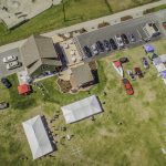
 Drones are increasingly being used for surveillance and observation based tasks, but a recent study from North Carolina State University suggests that we may have trouble identifying the images that are sent back from the drones.
“Because drones operate at heights that most normal aircraft do not, we are getting new aerial perspectives of our surroundings,” the author explains. “We wanted to know how good people are at integrating these perspectives into their perception of the real world environment – which can be relevant in situations such as security or emergency response operations.”
Perceiving the environment
For instance, it’s one thing for the drone to identify a particular spot, but can then humans behind the scenes then accurately identify that spot on a map? The researchers put participants through their paces on a range of scenarios that required them to look at various aerial images before looking at a second series of shots of the same environment from ground level. The ground level pictures had one object missing, and the participants were required to spot what it was.
To try and accurately reflect real life scenarios, the researchers gave participants various formulations of images. For instance, some would look at two aerial photos, some would compare two ground images, with others comparing a ground image followed by an aerial one.
The best combination seemed to be comparing two aerial views, with the biggest challenge being a switch from aerial to ground photo. When participants were shown images in this way, it took them at least a second longer to spot the missing object, with their estimates four times farther away from the correct location than when they viewed two aerial views.
“This tells us that incorporating drones into some situations, such as emergency response, may not necessarily be as useful as one might think,” the authors say. “It also offers insights into how we can modify training or interface design to improve performance for UAS users.”
Suffice to say, with drones increasingly able to identify objects autonomously, and not only identify them but locate them on a map, it may be a mute point that humans struggle to work with the images drones provide. For the time being however, the findings are at least food for thought.